
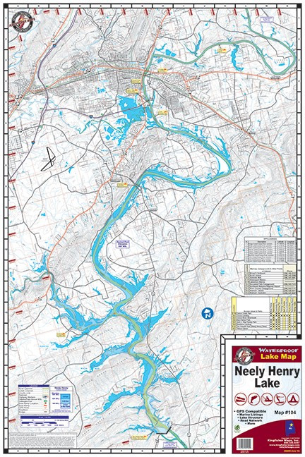
The Kingfisher Neely Henry Lake Waterproof Fishing Map #104 provides detailed coverage of Neely Henry Lake on the Coosa River near Gadsden, Alabama. Designed for anglers and boaters, this topographical map provides useful on-the-water information for locating structure, navigating the reservoir, and planning fishing trips.
The map displays 20-foot contour intervals, the main river channel, creek channels, marinas, campgrounds, boat ramps, and other lake features. Kingfisher also includes GPS coordinates and GPS grids, making the map a useful companion to modern marine electronics.
Printed on waterproof, tear-resistant material, the map is made to withstand regular use in a boat or tackle bag. It measures 24" x 36" when opened and conveniently folds down to approximately 6" x 9" for storage. The map uses a 1:36,000 scale and is one-sided.
Features:
- Detailed map of Neely Henry Lake, Alabama
- Kingfisher Map #104
- Waterproof and tear-resistant construction
- One-sided topographical fishing map
- 24" x 36" unfolded size
- Folds to approximately 6" x 9"
- 1:36,000 scale
- 20-foot contour intervals
- Shows main river channel and creek channels
- Includes marinas, campgrounds, and boat ramps
- GPS coordinates and GPS grids
- Covers Neely Henry Lake on the Coosa River near Gadsden, Alabama
- Compact folded design for boat or tackle-box storage